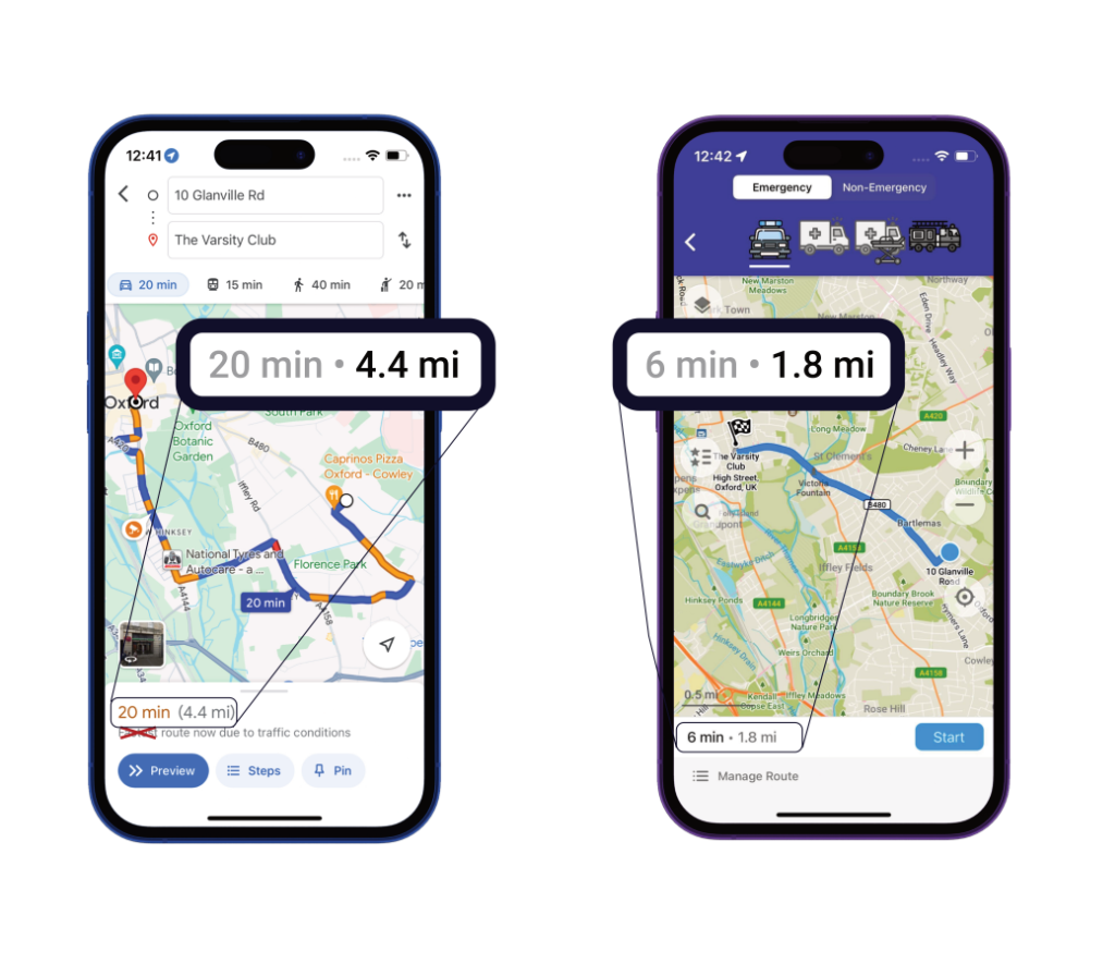
Built for the frontline, by the frontline.

Founded by a first responder, we're uniquely positioned to understand the needs of the emergency services - dedicated to delivering the tools we wish we had.

Custom Data Layers

Whether it's event footprints or fire hydrant locations, we ensure your data is accessible by frontline staff.

Mission Critical Resilience

Our offline maps still work when network connectivity is lost, meaning first responders can always respond.

Tailored For You

In owning the full data & software stack, we are uniquely positioned to be truly responsive to your needs.

Reduce response times

Our routing algorithm understands the nuances in how responders drive, helping them find faster routes to those in need.

Reduce response times

Improve road safety

There are over 50,000 blue light collisions a year. By giving advance warning to other drivers, we can reduce the risk of collision.

Improve road safety

Advanced Routing

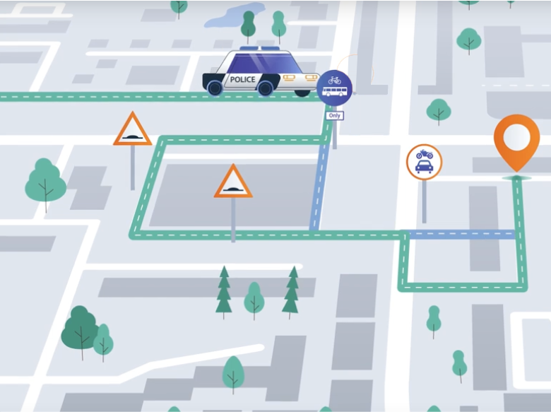
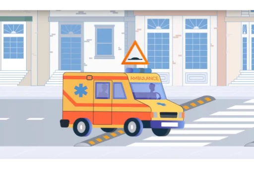
London Fire Brigade analysis shows that a speed hump delays a fire appliance by 10 seconds.

Schemes like Low Traffic Neighbourhoods are designed to ensure emergency vehicles can take traffic-free shortcuts.

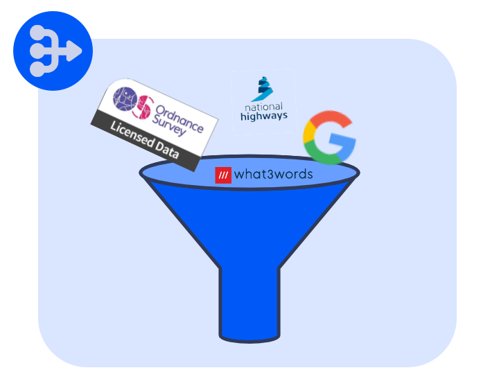
Our algorithm accounts for these factors, and many more.

  • Prioritises wide 'flowy' roads
  • Knows when rules don't apply
  • Width/height restrictions
  • Building entrance locations
  • Timely turn instructions
  • Road closures

Detailed Map Data

As an Ordnance Survey partner, we're the only supplier that equips your frontline staff with the same view as the control room.

That means every building number and name clearly visible on the map, from council estates to farm houses.

Combined with what3words, Google StreetView and OpenStreetMap data, we deliver true situational awareness to those that need it most.

Testimonials

What They Say About Us

Daniel Grew

Improved situational awareness and response efficiency

In Dorset and Wiltshire Fire Service we often deploy firefighters from wider operational areas, who may be unfamiliar with the local road network. Custom overlays displaying hydrant locations and risk information also provide vital insights before arriving on scene.

Daniel Grew

Technology Manager
Improved situational awareness and response efficiency
James Heathcote

Plenty of notice of upcoming junctions, important when travelling quickly

It’s great to be able to programme a route that takes into account the exemptions and doesn’t put me on the motorway all the time. Another nice touch is the image that pops up automatically in the corner showing the street view of the destination when you arrive.

James Heathcote

Police Officer
Plenty of notice of upcoming junctions, important when travelling quickly
Alex Penn

I have seen a huge difference in the large geographical area I cover, when using google maps alongside. Blue Light wins!

I often transport patients who are critically unstable, which requires the smoothest of runs. Believe it or not, some of our patients are transported with an open chest with substantial arterial lines etc. Blue Light Maps has made a huge difference to providing smoother journeys which aren't hit with speed bumps for miles.

Alex Penn

Critical Care Paramedic
I have seen a huge difference in the large geographical area I cover, when using google maps alongside. Blue Light wins!
Chad Underwood

Allowed us to get to an incident much quicker compared to following Google Maps

Been using this as an operator of a vehicle in a response car. So far have no complaints, and have been getting to incidents quicker utilising the map using blue light exemptions. For instance today we've used a bus-only road that would commonly be avoided on Google Maps.

Chad Underwood

Police Officer
Allowed us to get to an incident much quicker compared to following Google Maps
  • National Highways
  • Google
  • DfT
  • w3w
  • StreetView

Seamless integration

Built to fit your tech stack

Integrates seamlessly with your CAD. Easily deploy without disrupting existing infrastructure.

  • Waze
  • OS
  • OpenStreetMap
  • Esri
Esri

Esri

Transform traditional GIS data into real-time field intelligence, deploying updates in seconds.

Connect
Waze

Waze

Our Blue Light Alert integration with Waze means other drivers can be warned about an approaching emergency vehicle.

Connected

Get Started

Start Your Free Trial

Arrange a demo to see how we can help, and then get going with a trial.

  • Free 30 day trial
  • No paperwork required
  • Simple deployment